-
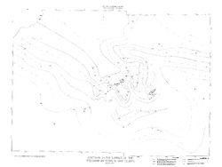
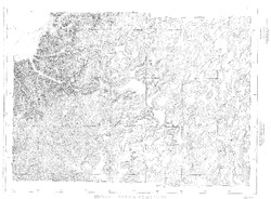
Contours on the Surface of the Precambrian Rocks in Dane County
Open-file report; contains unpublished data that has not yet been peer-reviewed.-
Contours on the Surface of the Precambrian Rocks in Dane County
1972
Map: 48 in x 36 in, scale 1:62,500
-
-
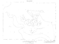
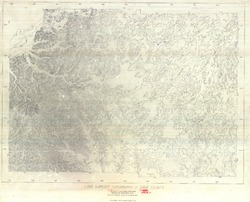
Contours on the Base of the Eau Claire Sandstone in Dane County
Open-file report; contains unpublished data that has not yet been peer-reviewed.-
Contours on the Base of the Eau Claire Sandstone in Dane County
1972
Map: 48 in x 36 in, scale 1:62,500
-
-
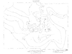
Contours on the Base of the Tunnel City Formation in Dane County
Open-file report; contains unpublished data that has not yet been peer-reviewed.-
Contours on the Base of the Tunnel City Formation in Dane County
1972
Map: 48 in x 36 in, scale 1:62,500
-
-
Bedrock Geology of Dane County
Open-file report; contains unpublished data that has not yet been peer-reviewed. -
Bedrock Topography of Dane County
Open-file report; contains unpublished data that has not yet been peer-reviewed. -
Land Surface Topography of Dane County
Open-file report; contains unpublished data that has not yet been peer-reviewed. -
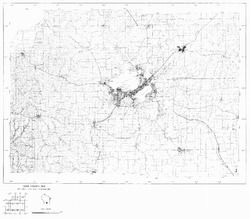
Dane County, Wisconsin (Base Map)
Open-file report; contains unpublished data that has not yet been peer-reviewed. -
Geology Field Trip Southwestern Dane County
Open-file report; contains unpublished data that has not yet been peer-reviewed. -
Geologic Structure in the Yahara Hills Golf Course Area in Southeast Madison, Wisconsin
Open-file report; contains unpublished data that has not yet been peer-reviewed. -
Log of Field Trip for Western Dane County, Wisconsin
Open-file report; contains unpublished data that has not yet been peer-reviewed. -
Location of Quarry Sites in the City of Madison
Open-file report; contains unpublished data that has not yet been peer-reviewed. -
A Weathering Study of the University Buildings
Open-file report; contains unpublished data that has not yet been peer-reviewed. -
Discussion of the Phenomena of Local Glaciation in the Driftless Region
Open-file report; contains unpublished data that has not yet been peer-reviewed. -
Studies in the Driftless Region of Wisconsin
Open-file report; contains unpublished data that has not yet been peer-reviewed. -
Geology of Wisconsin - Outcrop Descriptions
These descriptions illustrate various geologic formations, features, and characteristics. Individual descriptions are one to ten pages long, and include a map with specific location, a description of geologic features, and a discussion of the geologic significance.-
Adams County: Upper Wisconsin Dells (T14N R6E Sec28)
Report: 3 p.
-
Adams County: Friendship Mound (T17N R6E Sec5)
Report: 2 p.
-
Adams County: Hamilton Mound (T20N R6E Sec36)
Report: 4 p.
-
Ashland County: Mt. Whittelsey (T44N R2W Sec9A)
Report: 3 p.
-
Ashland County: Mellen Gabbro (T45N R2W Sec30)
Report: 3 p.
-
Ashland County: Mellen Granite (T45N R2W Sec31)
Report: 3 p.
-
Ashland County: White River (T46N R4W Sec6)
Report: 2 p.
-
Bayfield County: South Fish Creek (T47N R5W Sec20)
Report: 2 p.
- 123 more...
-
-
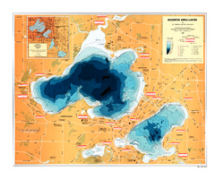
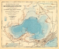
Hydrographic Map of Lake Mendota, Dane County, Wisconsin
-
Hydrographic Map of Lake Mendota, Dane County, Wisconsin
1953
Map: 24.4 in x 17.4 in, scale 1 in = 2,000 ft
-
-
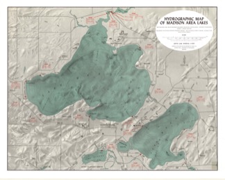
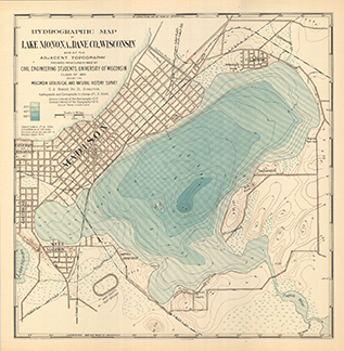
Hydrographic Map of Lake Monona, Dane County, Wisconsin, and of the Adjacent Topography
-
Hydrographic Map of Lake Monona, Dane County, Wisconsin, and of the Adjacent Topography
1900
Map: 18.7 in x 19.1 in, scale 1 in = 2,000 ft
-
-
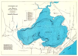
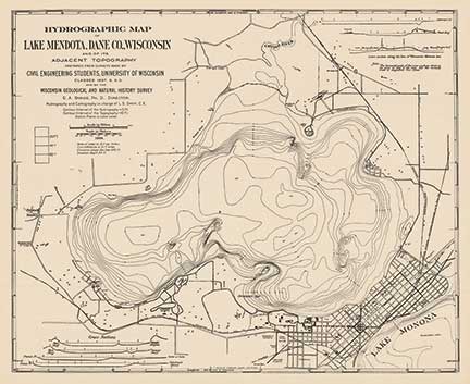
Hydrographic Map of Lake Mendota, Dane County, Wisconsin, and of Its Adjacent Topography
-
Hydrographic Map of Lake Mendota, Dane County, Wisconsin, and of Its Adjacent Topography
1900
Map: 24.9 in x 20.3 in, scale 1 in = 1/3 mile
-
Hydrographic Map of Lake Mendota, Dane County, Wisconsin, and of Its Adjacent Topography
1900
Map: 24.9 in x 20.7 in, scale 1 in = 1/3 mile
-

Publications Catalog
Wisconsin Geological and Natural History Survey