-
Elevation contours of the Precambrian surface of south-central Wisconsin
Elevation contour data and an accompanying report provide an updated interpretation of the elevation of the top of Precambrian bedrock in south-central Wisconsin. The elevation surface was developed from geologic and geophysical data, and provides new detail on the entrenched bedrock valleys that were incised into the north and south ranges of the Baraboo...-
Elevation contours of the Precambrian surface of south-central Wisconsin [dataset 1]
2022
GIS Data: File geodatabase (.gdb file format)
-
-
Hydrogeology of the sandy uplands of the Bayfield Peninsula, Wisconsin
The sandy uplands of the Bayfield Peninsula are primary contributors to regional groundwater recharge and provide baseflow to streams in the area. Few data exist, however, to characterize upland hydrogeology or its susceptibility to groundwater contamination. Here, data from two new cores and wells, one existing well, and a lake in the sandy uplands...-
Rotosonic core data from the sandy uplands of the Bayfield Peninsula, Wisconsin [dataset 1]
2022
Data: Spreadsheets (.csv file format)
-
Water-level measurements from two monitoring wells in the sandy uplands of the Bayfield Peninsula, Wisconsin [dataset 2]
2022
Data: Spreadsheets (.csv file format)
-
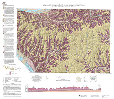
Geologic map of the Bloomington and Brodtville 7.5-minute quadrangles, Grant County, Wisconsin
The geologic map of the Bloomington and Brodtville quadrangles includes 1:24,000 scale mapping of both surficial and bedrock geology. There is little structural folding or faulting in this portion of the Driftless Area. Thus, it is ideal for studying the hydrostratigraphic framework of the mapped units. The accompanying report presents stratigraphic...-
Geologic map of the Bloomington and Brodtville 7.5-minute quadrangles, Grant County, Wisconsin
2022
Map: 41 in x 35 in, scale 1:24,000
-
GIS data for the geologic map of the Bloomington and Brodtville 7.5-minute quadrangles, Grant County, Wisconsin [dataset 1]
2022
GIS Data: File geodatabase (.gdb file format)
-
-
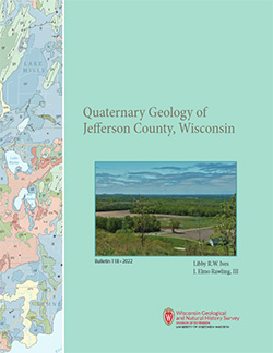
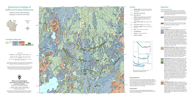
Quaternary Geology of Jefferson County, Wisconsin
The Quaternary geologic map of Jefferson County, Wisconsin, provides details about the surficial sediment and landscapes that were formed largely in the footprint of the Laurentide Ice Sheet's southern Green Bay Lobe during the late Wisconsin Glaciation (ca. 20,000 years before present). These landscapes include lowlands underlain by glacial and...-
GIS Data for Quaternary Geology of Jefferson County, Wisconsin [dataset 1]
2022
GIS Data: GeMS file geodatabase (.gdb file format), shapefiles (.shp file format)
-
Quaternary Geology of Jefferson County, Wisconsin [plate 1]
2022
Map: 34.5 in x 18 in, scale 1:100,000
-
Wisconsin Groundwater-Level Monitoring Network Improvements, 2018-2021
This report documents work completed as part of a grant from the U.S. Geological Survey’s National Groundwater Monitoring Network (NGWMN) program. It provides an overview of the Wisconsin Groundwater-Level Monitoring Network (WGLMN) and provides detailed description of well evaluation and repair activities, and drilling of new monitoring wells across the... -
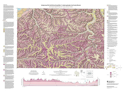
Geologic map of the Castle Rock and Long Hollow 7.5-minute quadrangles, Grant County, Wisconsin
The geologic map of the Castle Rock and Long Hollow quadrangles includes 1:24,000 scale mapping of both surficial and bedrock geology. The accompanying report presents new observations about bedrock folds and fracture sets in this portion of the Driftless Area that lies just north of the main Upper Mississippi Valley zinc-lead mineral district. The...-
Geologic map of the Castle Rock and Long Hollow 7.5-minute quadrangles, Grant County, Wisconsin (revised 2022)
2022
Map: 48 in x 36 in, scale 1:24,000
-
GIS data for the geologic map of the Castle Rock and Long Hollow 7.5-minute quadrangles, Grant County, Wisconsin [dataset 1]
2022
GIS Data: File geodatabase (.gdb file format)
-
-
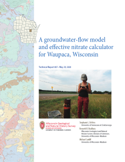
A Groundwater-Flow Model and Effective Nitrate Calculator for Waupaca, Wisconsin
The City of Waupaca, Wisconsin, uses groundwater pumped from a network of seven high-capacity wells as its municipal water supply. Recent increases in the concentration of nitrate in the municipal water supply raised questions about the source of this contamination and whether it might eventually exceed standards for drinking water. This study combines...-
Geodatabase of Study Data from Waupaca, Wisconsin [dataset 1]
2022
GIS Data: File geodatabase (.gdb file format)
-
Groundwater Flow Modeling Files from Waupaca, Wisconsin [dataset 2]
2022
Data: Groundwater flow model (.gfl file format)
-
Nitrate Calculators for Municipal Wells in Waupaca, Wisconsin [dataset 3]
2022
Data: Spreadsheets (.xlsx file format)

Publications Catalog
Wisconsin Geological and Natural History Survey