-
Bedrock Geology of Grant County, Wisconsin
Three-dimensional bedrock mapping of Grant County at a scale of 1:100,000 provides new baseline information on the distribution of geologic units. Grant County contains Paleozoic bedrock units ranging in age from Silurian to Cambrian. Gentle folds and small faults deform the Paleozoic sequence and were mapped based on structure contours of the base of the...-
GIS Data for Bedrock Geology of Grant County, Wisconsin [dataset 1]
2025
GIS Data: GeMS Level 3 file geodatabase (.gdb file format), GeoPackage (.gpkg file format)
-
Geochemical Data for Bedrock Geology of Grant County, Wisconsin [dataset 2]
2025
Data: Spreadsheets (.csv file format)
-
GIS Data for Bedrock Geology of Grant County, Wisconsin [dataset 3]
2025
GIS Data: File geodatabase (.gdb file format)
-
Report on Lead and Zinc Deposits of Wisconsin, with an Atlas of Detailed Geologic and Topographic Maps of Southwestern Wisconsin
-
Report on the Lead and Zinc Deposits of Wisconsin With an Atlas of Detailed Maps
1906
Report: 100 p.
-
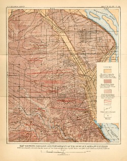
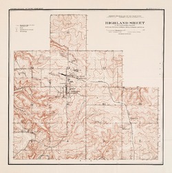
Highland Sheet of the Lead and Zinc District [topography] [plate 1]
1906
Map: 19.1 in x 19.2 in, scale 4 in = 1 mile
-
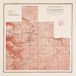
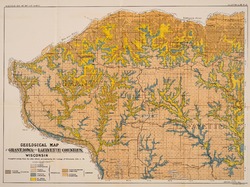
Highland Sheet of the Lead and Zinc District [geology] [plate 2]
1906
Map: 19.1 in x 19.1 in, scale 4 in = 1 mile
-
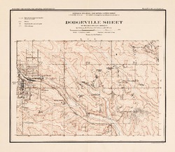
Dodgeville Sheet of the Lead and Zinc District [topography] [plate 3]
1906
Map: 14.8 in x 12.9 in, scale 4 in = 1 mile
-
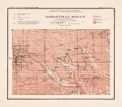
Dodgeville Sheet of the Lead and Zinc District [geology] [plate 4]
1906
Map: 15.0 in x 13.2 in, scale 4 in = 1 mile
-
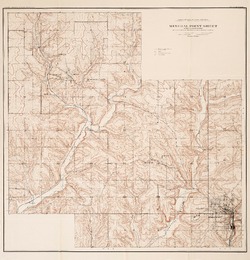
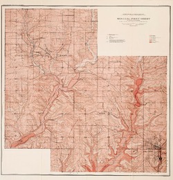
Mineral Point Sheet of the Lead and Zinc District [topography] [plate 5]
1906
Map: 19.9 in x 20.7 in, scale 4 in = 1 mile
-
Mineral Point Sheet of the Lead and Zinc District [geology] [plate 6]
1906
Map: 19.9 in x 20.7 in, scale 4 in = 1 mile
-
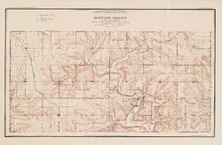
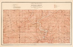
Mifflin Sheet of the Lead and Zinc District [topography] [plate 7]
1906
Map: 24.5 in x 17.3 in, scale 4 in = 1 mile
-
Mifflin Sheet of the Lead and Zinc District [geology] [plate 8]
1906
Map: 26.1 in x 16.8 in, scale 4 in = 1 mile
-
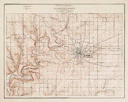
Platteville Sheet of the Lead and Zinc District [topography] [plate 9]
1906
Map: 20.6 in x 16.5 in, scale 4 in = 1 mile
- 16 more...
-

Publications Catalog
Wisconsin Geological and Natural History Survey