-
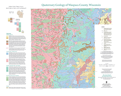
Quaternary Geology of Waupaca County, Wisconsin
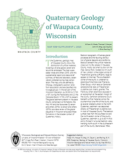
The Quaternary geologic map of Waupaca County, Wisconsin, provides details about the surficial sediment and landscapes that were formed underneath and adjacent to the Laurentide Ice Sheet during the late Wisconsin Glaciation (ca. 20,000 years before present). These landscapes include lowlands underlain by glacial and postglacial lake sediment, uplands...-
Geologic Log Data for Quaternary Geology of Waupaca County, Wisconsin [dataset 1]
2023
Data: Spreadsheets (.xlsx file format)
-
GIS Data for Quaternary Geology of Waupaca County, Wisconsin [dataset 2]
2023
GIS Data: GeMS Level 3 file geodatabase (.gdb file format), shapefiles (.shp file format), GeoPackage (.gpkg file format)
-
A Groundwater-Flow Model and Effective Nitrate Calculator for Waupaca, Wisconsin
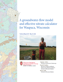
The City of Waupaca, Wisconsin, uses groundwater pumped from a network of seven high-capacity wells as its municipal water supply. Recent increases in the concentration of nitrate in the municipal water supply raised questions about the source of this contamination and whether it might eventually exceed standards for drinking water. This study combines...-
Geodatabase of Study Data from Waupaca, Wisconsin [dataset 1]
2022
GIS Data: File geodatabase (.gdb file format)
-
Groundwater Flow Modeling Files from Waupaca, Wisconsin [dataset 2]
2022
Data: Groundwater flow model (.gfl file format)
-
Nitrate Calculators for Municipal Wells in Waupaca, Wisconsin [dataset 3]
2022
Data: Spreadsheets (.xlsx file format)
-
Central Sands Lakes Study: Annotated Bibliography
The authors of this open-file report scoured the literature for previous studies about the Central Sands area. This bibliography provides an overview of available research related to the hydrogeologic setting and water-budget components of the Central Sands Lakes Study (CSLS). -
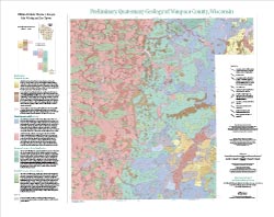
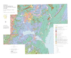
Preliminary Quaternary Geology of Waupaca County, Wisconsin
This open-file report contains a map (PDF) and GIS data (shapefiles) of the glacial and post-glacial deposits of Waupaca County in central Wisconsin. This map and GIS data were superseded by a Map Series publication in 2023: https://doi.org/10.54915/bger3320.-
Preliminary Quaternary Geology of Waupaca County, Wisconsin [plate 1]
2015
Map: 29 in x 23 in, scale 1:100,000
-
Preliminary Quaternary Geology of Waupaca County, Wisconsin [GIS data]
2015
GIS Data: Shapefiles (.shp file format)
-
-
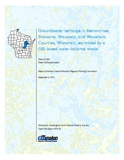
Groundwater Recharge in Menominee, Shawano, Waupaca, and Waushara Counties, Wisconsin, Estimated by a GIS-Based Water-Balance Model
This open-file report documents the recharge model created for the East Central Wisconsin Regional Planning Commission. Includes the resulting recharge map, a useful tool for land-use planners interested in identifying important groundwater recharge areas. -
Preliminary Quaternary Geologic Map of the Central Fox River Lowland, Wisconsin
Open-file report; contains unpublished data that has not yet been peer-reviewed.-
Preliminary Quaternary Geologic Map of the Central Fox River Lowland, Wisconsin
2004
Map: 39 in x 32 in, scale 1:100,000
-
-
Merging Pleistocene Lithostratigraphy with Geotechnical and Hydrogeologic Data--Examples from Eastern Wisconsin
Open-file report; contains unpublished data that has not yet been peer-reviewed. -
New Water Supply at Waupaca, Wisconsin
Open-file report; contains unpublished data that has not yet been peer-reviewed. -
Field Report, Glacial Geology of Portage, Waupaca and Outagamie Counties
Open-file report; contains unpublished data that has not yet been peer-reviewed. -
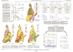
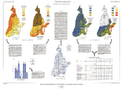
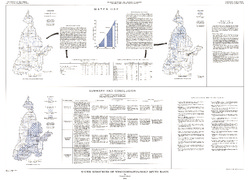
Water Resources of Wisconsin - Rock-Fox River Basin, Hydrologic Investigations Atlas HA-360
-
Water Resources of Wisconsin, Fox-Wolf River Basin: Plate 1, Physical Setting, Water System
1968
Plate: 38 in x 27.25 in
-
Water Resources of Wisconsin, Fox-Wolf River Basin: Plate 2, Ground Water
1968
Plate: 38 in x 27.25 in
-
-
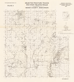
Irrigable Lands Inventory--Phase I Groundwater and Related Information
This paper contains hydrogeologic information for the Golden Sands Resource Conservation and Development Area in central Wisconsin. The set of maps includes water-table elevation maps for the following counties: Adams, Jackson, Juneau, Marathon, Marquette, Monroe, Portage, Waupaca, Waushara, and Wood (scale 1:126,720). It also includes a regional aquifer...-
Irrigable Lands Inventory - Phase I Groundwater and Related Information
1981
Report: 13 p., 11 maps, scale 1:126,720 and 1:500,000
- 2 more...
-
-
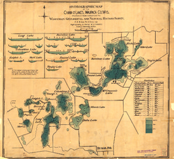
Hydrographic Map of the Chain-O'-Lakes, Waupaca County, Wisconsin
-
Hydrographic Map of the Chain-O'-Lakes, Waupaca County, Wisconsin
1898
Map: 22.8 in x 20.8 in, scale 1 in = 1/6 mile
-
-
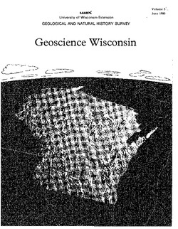
Geoscience Wisconsin Volume 13
-
Precambrian Metamorphism in the Southern Lake Superior Region and Its Bearing on Crustal Evolution
1989
Journal Article: p. 1-33
-
U.S. Department of Energy Publications on Uranium and Radiometric Surveys of Wisconsin
1989
Journal Article: p. 62-66
-
Geoscience Wisconsin Volume 08
-
The Pleistocene Stratigraphy and Geomorphology of Central-Southern Wisconsin and Part of Northern Illinois
1983
Journal Article: p. 22-44
-
Geophysical Evidence That the Haeger Till Member Underlies Southern Western Lake Michigan
1983
Journal Article: p. 45-58
-
Atlas of the Geological Survey of Wisconsin
Collection of most of the plates accompanying Chamberlin's four-volume Geology of Wisconsin: Survey of 1873-1879.-
Atlas of the Geological Survey of Wisconsin: General Geological Map of Wisconsin [plate 1]
1882
Map: 25.5 in x 30.3 in, scale 1 in = 15 miles
-
Atlas of the Geological Survey of Wisconsin: General Map of Quaternary Formations [plate 2]
1882
Map: 28.2 in x 32.4 in
-
Atlas of the Geological Survey of Wisconsin: General Map of Native Vegetation [plate 2A]
1882
Map: 28.2 in x 32.4 in
-
Atlas of the Geological Survey of Wisconsin: General Map of Soils [plate 2B]
1882
Map: 28.2 in x 32.5 in
-
Atlas of the Geological Survey of Wisconsin: Map of Rainfall and Temperature [plate 2C]
1882
Map: 27.7 in x 32.5 in
-
Atlas of the Geological Survey of Wisconsin: Maps of Subsoils and Native Vegetation of Eastern Wisconsin [plate 3]
1877
Map: 27.82 in x 32.17 in, scale 1 in = 12 miles
-
Atlas of the Geological Survey of Wisconsin: Maps of Topography and Quaternary Formations of Eastern Wisconsin [plate 4]
1877
Map: 27.83 in x 32.06 in, scale 1 in = 12 miles
-
Atlas of the Geological Survey of Wisconsin: Geology and Topography of the Lead Region [plate 5]
1877
Map: 27.68 in x 32.18 in
-
Atlas of the Geological Survey of Wisconsin: Geology and Topography of the Lead Region [plate 6]
1877
Map: 23.98 in x 28.94 in
-
Atlas of the Geological Survey of Wisconsin: Geology and Topography of the Lead Region [plate 8]
1877
Map: 24.03 in x 28.38 in
- 32 more...
-
-
The Wolf River Batholith and Baraboo Interval in Central Wisconsin
Prepared for 32nd Annual Meeting Institute on Lake Superior Geology.

Publications Catalog
Wisconsin Geological and Natural History Survey