-
Central Sands Lakes Study: Annotated Bibliography
The authors of this open-file report scoured the literature for previous studies about the Central Sands area. This bibliography provides an overview of available research related to the hydrogeologic setting and water-budget components of the Central Sands Lakes Study (CSLS). -
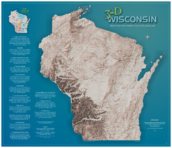
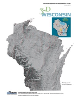
3-D Wisconsin
When viewed with 3-D glasses, Wisconsin’s land features pop off the page. Brief descriptions of major land forms paint the geologic history that shaped the state; expanded descriptions and photos are online. We’ve field-tested this map on fourth graders and can attest to its appeal. Sizes: 27.5 x 32 inches, 8.5 x 11 inches. Requires red-blue 3-D glasses. -
Field Trip: Cambrian and Ordovician Stratigraphy of Southwestern Wisconsin
Field trip route and notes looking at Cambrian and Middle Ordovician rocks of southwestern Wisconsin. -
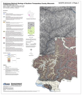
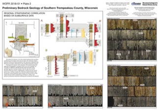
Preliminary Bedrock Geology of Southern Trempealeau County, Wisconsin
This open-file report documents the first year of a two-year mapping project in Trempealeau County, Wisconsin. This preliminary document is being released to encourage input on the mapping methods and map to make the final product as useful as possible. Contains 27-page report, map of southern Trempeleau County, cross section, and photos of drill core.-
Preliminary Bedrock Geology of Southern Trempealeau County, Wisconsin [plate 1]
2018
Plate: 26 in x 30 in, scale 1:100,000
-
Preliminary Bedrock Geology of Southern Trempealeau County, Wisconsin [plate 2]
2018
Plate: 27.8 in x 24.85 in
-
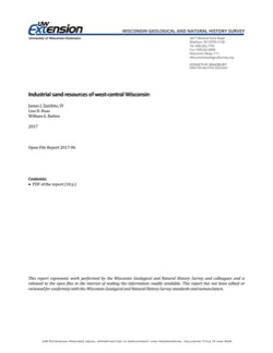
Industrial Sand Resources of West-Central Wisconsin
Field trip guidebook showcasing four sites in Trempealeau County in west-central Wisconsin. The focus of this trip is on the sandstone formations that are prized for frac sand mining. (A draft of this book was originally prepared for the 2017 American Institute of Professional Geologists (AIPG) Sand Mine Life Cycle Seminar held in Eau Claire, Wisconsin.) -
Hydrogeological Characterization of the Town of Lincoln, Kewaunee County, Wisconsin
Report, maps, and GIS data cataloging the groundwater and hydrogeologic conditions in Kewaunee County's Town of Lincoln.-
Hydrogeological Characterization of the Town of Lincoln, Kewaunee County, Wisconsin
2017
Report: report (33 p.), 8 maps (11 in x 17 in, 1:50,000 scale), and appendix (15 p.)
-
Hydrogeological characterization of the Town of Lincoln, Kewaunee County, Wisconsin [GIS data]
2017
GIS Data: Shapefiles, metadata
-
-
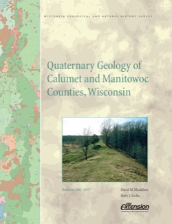
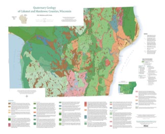
Quaternary Geology of Calumet and Manitowoc Counties, Wisconsin
All of what is now Calumet and Manitowoc Counties was covered by ice during the last great glaciation, between 30,000 and 11,000 years ago. This bulletin explains the glacial history, interprets the deposits left behind, and portrays the distribution of the deposits on a map and cross sections. This report should be useful to planners and development...-
Quaternary Geology of Calumet and Manitowoc Counties, Wisconsin [GIS data]
2017
GIS Data: Shapefiles, metadata
-
Quaternary Geology of Calumet and Manitowoc Counties, Wisconsin [plate 1]
2017
Plate: 35.5 in x 29 in, scale 1:100,000
-
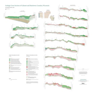
Geologic Cross Sections of Calumet and Manitowoc Counties, Wisconsin [plate 2]
2017
Plate: 36.67 in x 36.67 in, scale 1:100,000
-
Wisconsin Groundwater-Level Monitoring Network Improvement
The Wisconsin Groundwater-Level Monitoring Network consists of 93 wells and 2 spring gaging stations. This report documents work performed on seven of the wells between August 1, 2016 and July 31, 2017, and appendices provide historical reference documents. -
Elemental Chemostratigraphy of the Cottage Grove Hole MP-18 Core: Implications for Litho- and Hydrostratigraphy in Southcentral Wisconsin
Part of a larger regional study of the Eau Claire Formation, the core, from Dane County, Wisconsin, was tested using a portable x-ray fluorescence (pXRF) elemental analyzer. The report presents the data set and discusses lithologic interpretations, subsurface lithostratigraphic correlations, and hydrostratigraphic frameworks. Includes photos of the core. -
Bayfield County [Wisconsin] Water-Table Map and Water Well Database
This report provides information about well construction, groundwater flow, and resulting implications for well susceptibility in Bayfield County, Wisconsin. The work follows an earlier groundwater study that focused on two agricultural areas within Bayfield County.-
Generalized Water-Table Elevation Map for Bayfield County, Wisconsin [GIS data]
2017
GIS Data: Shapefiles
-
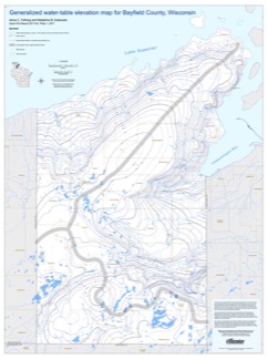
Generalized Water-Table Elevation Map for Bayfield County, Wisconsin [plate 1]
2017
Plate: 30 in x 40 in, scale 1:100,000
-
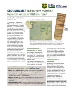
Groundwater and Fractured Crystalline Bedrock in Wisconsin's National Forest
An exploratory borehole drilled into the fractured crystalline (granite) bedrock in Chequamegon-Nicolet National Forest provided a rare opportunity to investigate groundwater flow. This 2-page factsheet provides insights that can be applied to groundwater management in bedrock aquifers. -
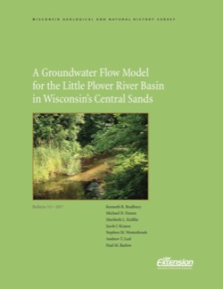
A Groundwater Flow Model for the Little Plover River Basin in Wisconsin's Central Sands
The bulletin describes the state-of-the-art scientific tool that can be used to help make good decisions about high-capacity well placement and pumping, as well as land use in Wisconsin's Central Sands region. It can also be used to predict which wells and well locations would have the greatest impact on nearby lakes and streams. The user's manual...-
A Groundwater Flow Model for the Little Plover River Basin in Wisconsin’s Central Sands [appendices]
2017
Data: PDFs + Excel files
-
Portable X-Ray Fluorescence (pXRF) Measurements of Uranium and Thorium in Madison, Wisconsin, Water Utility Wells 4 and 27
Concentrations of radium at or above the health standard in a Madison municipal well prompted the water utility to request assistance from the Wisconsin Geological and Natural History Survey to better understand the source of the radium. This report documents a series of analyses performed on the elemental composition of rock samples from the affected...-
Portable X-Ray Fluorescence (pXRF) Measurements of Uranium and Thorium in Madison, Wisconsin, Water Utility Wells 4 and 27
2017
Report: 10 p. (report) + 28 p. (2 appendices)
-
-
Hydrogeology of Fort McCoy Geothermal Test Well 5
Test hole drilled to 1,000 feet on Fort McCoy property provides data for understanding the geothermal gradient in Wisconsin and the hydrogeologic conditions found at Fort McCoy.-
Hydrogeology of Fort McCoy Geothermal Test Well 5 [appendices]
2016
Data: PDF files + Excel spreadsheet
-
Sampling Methodologies and Data Analysis Techniques for Geologic Materials Using Portable X-Ray Fluorescence (pXRF) Elemental Analysis
Details the current WGNHS approach to pXRF analysis, including usage guidelines, sample preparation, calibration, and plotting techniques.-
Sampling Methodologies and Data Analysis Techniques for Geologic Materials Using Portable X-Ray Fluorescence (pXRF) Elemental Analysis [appendices]
2016
Data: PDF files + Excel spreadsheet
-
Quaternary Geology of Door County, Wisconsin
Traces the complex glacial history of Door County. Map shows glacial units with shaded relief. -
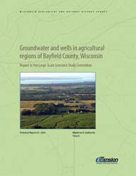
Groundwater and Wells in Agricultural Regions of Bayfield County, Wisconsin: Report to the Large-Scale Livestock Study Committee
Information and recommendations concerning groundwater and water supply wells in two agricultural regions in Bayfield County, Wisconsin. Includes a report, a water-table map, a set of four cross sections, and GIS data. (Replaces WOFR2015-02.)-
Groundwater and Wells in Agricultural Regions of Bayfield County, Wisconsin [GIS data]
2016
GIS Data: Shapefiles, metadata
-
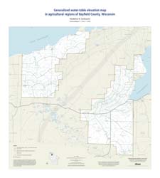
Generalized Water-Table Elevation Map in Agricultural Regions of Bayfield County, Wisconsin [plate 1]
2016
Map: 27 in x 30 in, scale 1:100,000
-
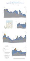
Hydrogeologic Cross Sections in Agricultural Regions of Bayfield County, Wisconsin [plate 2]
2016
Plate: 20.25 in x 40.25 in, scale 1:100,000
-
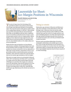
Laurentide Ice Sheet: Ice-Margin Positions in Wisconsin
Series of 43 page-size maps showing the chronology of the last glaciation's advances and retreats across Wisconsin. Includes a brief discussion about how the maps were made, how lake positions were determined, as well as a list of selected references. -
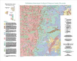
Preliminary Quaternary Geology of Waupaca County, Wisconsin
This open-file report contains a map (PDF) and GIS data (shapefiles) of the glacial and post-glacial deposits of Waupaca County in central Wisconsin. This map and GIS data were superseded by a Map Series publication in 2023: https://doi.org/10.54915/bger3320.-
Preliminary Quaternary Geology of Waupaca County, Wisconsin [plate 1]
2015
Map: 29 in x 23 in, scale 1:100,000
-
-
The 2016 Groundwater Flow Model for Dane County, Wisconsin
The 2016 groundwater flow model is a three-dimensional model using state-of-the-art representation of the hydrogeology of Dane County. This report describes the model, appendices provide data, and the user's manual provides basic instructions and recommendations for running the model.-
The 2016 Groundwater Flow Model for Dane County, Wisconsin [appendices]
2016
Data: Excel spreadsheet

Publications Catalog
Wisconsin Geological and Natural History Survey