-
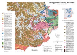
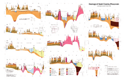
Geology of Sauk County, Wisconsin
Geologic history and description of Sauk County, the home of Devils Lake and Parfreys Glen. Includes four-color bedrock map and cross sections. Map and cross sections are folded.-
GIS Data for the Geology of Sauk County, Wisconsin (version 2) [dataset 1]
1990
GIS Data: GeMS Level 3 file geodatabase (.gdb file format), shapefiles (.shp file format)
-
A Subsurface Study of the St. Peter Sandstone in Southern and Eastern Wisconsin
-
Structure Contour Map of the Pre-St. Peter Sandstone Erosion Surface in Southern and Eastern Wisconsin [plate 1]
1985
Map: 39.7 in x 23.5 in, scale 1:750,000
-
Paleogeologic Map of the Pre-St. Peter Sandstone Surface in Southern and Eastern Wisconsin & Thickness Map of the St. Peter Sandstone in Southern and Eastern Wisconsin [plate 2]
1985
Map: 39.4 in x 23.6 in, scale 1:750,000
-
Pleistocene Geology of Southern Wisconsin
Field trip guide with special papers by R.F. Black, N.K. Bleuer, F.D. Hole, N.P. Lasca, and L.J. Maher, Jr., 1970, 175 p. -
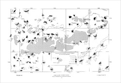
Geology of the Baraboo District, Wisconsin: A Description and Field Guide Incorporating Structural Analysis of the Precambrian Rocks and Sedimentologic Studies of the Paleozoic Strata
With summaries: Glacial Geology, R.F. Black; and Plant Ecology of the Baraboo Hills, J.H. Zimmerman.-
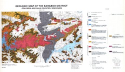
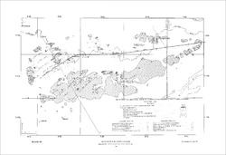
Geologic Map of the Baraboo District, Columbia and Sauk Counties, Wisconsin [plate 1]
1970
Map: 39.5 in x 22.7 in, scale 1:62,500
-
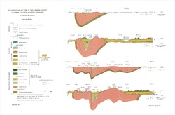
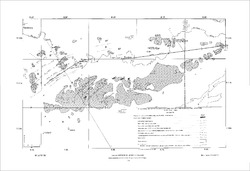
Geologic Cross Sections of the Baraboo District, Columbia and Sauk Counties, Wisconsin [plate 2]
1970
Plate: 32 in x 21 in
-
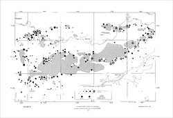
Map of Main Phase Minor Structures in the Baraboo Syncline, Columbia and Sauk Counties, Wisconsin [plate 3]
1970
Map: 31.5 in x 21.5 in
-
Structural Map of the Baraboo Syncline, Columbia and Sauk Counties, Wisconsin [plate 4]
1970
Map: 31.5 in x 21.5 in
-
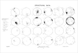
Structural Data: Lower Hemisphere Equal-Area Stereoplots of Structural Elements in the Baraboo Quartzite [plate 5]
1970
Plate: 31.5 in x 21.5 in
-
Orientations of Cross Stratification in Cambrian and Ordovician Sandstones [plate 7]
1970
Map: 31.5 in x 21.5 in
-
Field Trip Guidebook for Cambrian-Ordovician Geology of Western Wisconsin
With special papers: Lithologic Cycles in Lower Paleozoic Rocks of Western Wisconsin, M.E. Ostrom; and Lithostratigraphy of the Prairie du Chien Group, R.A. Davis, Jr. -
Cambrian Stratigraphy in Western Wisconsin
Notes accompanying a 1966 conference field trip covering geology between Chippewa Falls and Trempealeau and between Elroy and Portage. Routes shown. -
Cambro-Ordovician Stratigraphy of Southwest Wisconsin
In 1965, the authors wrote that the "Cambrian and Ordovician rocks of the Upper Mississippi Valley area have been subjected to what at one time would have been considered 'exhaustive study.'" This report reexamines the "classic" explanations. -
Geoscience Wisconsin Volume 17
-
Paleoecology and Sedimentology of the Prasopora Zonule in the Dunleith Formation (Ordovician), Upper Mississippi Valley
2007
Journal Article: p. 11-20
-
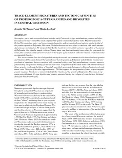
Trace-Element Signatures and Tectonic Affinities of Proterozoic A-Type Granites and Rhyolites in Central Wisconsin
2007
Journal Article: p. 35-51
-
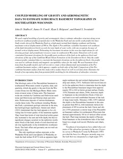
Coupled Modeling of Gravity and Aeromagnetic Data to Estimate Subsurface Basement Topography in Southeastern Wisconsin
2007
Journal Article: p. 53-64
-
Atlas of the Geological Survey of Wisconsin
Collection of most of the plates accompanying Chamberlin's four-volume Geology of Wisconsin: Survey of 1873-1879.-
Atlas of the Geological Survey of Wisconsin: General Geological Map of Wisconsin [plate 1]
1882
Map: 25.5 in x 30.3 in, scale 1 in = 15 miles
-
Atlas of the Geological Survey of Wisconsin: General Map of Quaternary Formations [plate 2]
1882
Map: 28.2 in x 32.4 in
-
Atlas of the Geological Survey of Wisconsin: General Map of Native Vegetation [plate 2A]
1882
Map: 28.2 in x 32.4 in
-
Atlas of the Geological Survey of Wisconsin: General Map of Soils [plate 2B]
1882
Map: 28.2 in x 32.5 in
-
Atlas of the Geological Survey of Wisconsin: Map of Rainfall and Temperature [plate 2C]
1882
Map: 27.7 in x 32.5 in
-
Atlas of the Geological Survey of Wisconsin: Maps of Subsoils and Native Vegetation of Eastern Wisconsin [plate 3]
1877
Map: 27.82 in x 32.17 in, scale 1 in = 12 miles
-
Atlas of the Geological Survey of Wisconsin: Maps of Topography and Quaternary Formations of Eastern Wisconsin [plate 4]
1877
Map: 27.83 in x 32.06 in, scale 1 in = 12 miles
-
Atlas of the Geological Survey of Wisconsin: Geology and Topography of the Lead Region [plate 5]
1877
Map: 27.68 in x 32.18 in
-
Atlas of the Geological Survey of Wisconsin: Geology and Topography of the Lead Region [plate 6]
1877
Map: 23.98 in x 28.94 in
-
Atlas of the Geological Survey of Wisconsin: Geology and Topography of the Lead Region [plate 8]
1877
Map: 24.03 in x 28.38 in
- 32 more...
-
-
A Voyageur's Guide to the Lower Wisconsin River
This booklet covers the Wisconsin River from Prairie du Sac to the Mississippi River. It is a traveler’s guide, with boating safety tips as well as an educational guide to the history and natural history of the river. -
Lithostratigraphy, Petrology, and Sedimentology of Late Cambrian--Early Ordovician Rocks near Madison, Wisconsin
Prepared for 8th Annual Meeting, Great Lakes Section, Society of Economic Paleontologists and Mineralogists. -
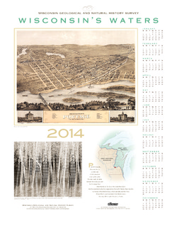
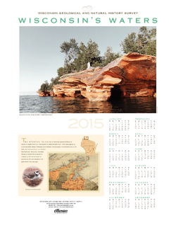
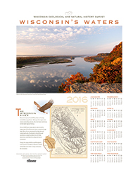
Wisconsin's Waters [2011-2016]
The Survey's annual poster calendar featuring Wisconsin scenery. The 2016 image showcases the Wisconsin River from the Ferry Bluff overlook. -
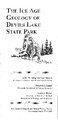
The Ice Age Geology of Devils Lake State Park
Devils Lake State Park is a place of striking geologic contrasts, where some of the oldest rock exposed in southern Wisconsin lies next to some of the youngest geologic materials in the state. The purple rock (called Baraboo quartzite) in the walls of Devils Lake gorge is more than 1.7 billion years old; the glacially deposited ridges that block both ends...-
The Ice Age Geology of Devils Lake State Park
1990
Report: 28 p., 1 plate, 18 in x 24 in, scale 1:24,000
-
-
The Baraboo Iron-Bearing District of Wisconsin
-
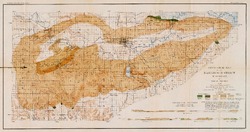
Geological Map of the Baraboo District, Wisconsin [plate 1]
1904
Map: 19.5 in x 10.3 in, scale 1 in = 1 mile vertical, 2 in = 1 mile horizontal

Publications Catalog
Wisconsin Geological and Natural History Survey