-
Evaluation of Groundwater Pumping to Reduce the Level of Crystal Lake in Columbia County, Wisconsin
Open-file report; contains unpublished data that has not yet been peer-reviewed.-
Evaluation of Groundwater Pumping to Reduce the Level of Crystal Lake, Columbia County, Wisconsin [appendices]
2012
Data: Multiple PDF files + data files (comma-delimited)
-
Hydrostratigraphy of West-Central Wisconsin: A New Approach to Groundwater Management
Open-file report; contains unpublished data that has not yet been peer-reviewed.-
Hydrostratigraphy of West-Central Wisconsin: A New Approach to Groundwater Management
2008
Report: 10 p. + appendices A1-A7
-
Hydrostratigraphy of West-Central Wisconsin: A New Approach to Groundwater Management [data]
2008
Data: Multiple PDF files + data
-
-
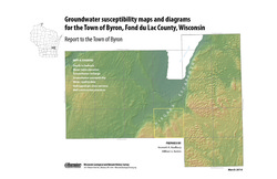
Groundwater Susceptibility Maps, Diagrams, and Report for the Town of Byron, Fond du Lac County, Wisconsin
Open-file report; contains unpublished data that has not yet been peer-reviewed.-
Groundwater Susceptibility Maps and Diagrams for the Town of Byron, Fond du Lac County, Wisconsin
2010
Report: 16 p. + 7 color plates
-
-
Drawdown in the Northeast Groundwater Management Area (Brown, Outagamie, and Calumet Counties, Wisconsin)
Open-file report; contains unpublished data that has not yet been peer-reviewed. -
Groundwater Flow Model for the Geneva Lake Area, Walworth County, Wisconsin
Open-file report; contains unpublished data that has not yet been peer-reviewed. -
Impacts of Land Use and Groundwater Flow on the Temperature of Wisconsin Trout Streams: Final Report
Open-file report; contains unpublished data that has not yet been peer-reviewed. -
Report on the Preliminary Investigation of Arsenic in Groundwater near Lake Geneva, Wisconsin
Open-file report; contains unpublished data that has not yet been peer-reviewed.-
Report on the Preliminary Investigation of Arsenic in Groundwater Near Lake Geneva, Wisconsin
2000
Report: 19 p. + 5 color pages
-
-
Hydrogeology and Groundwater Monitoring of Fractured Dolomite in the Upper Door Priority Watershed, Door County, Wisconsin
Open-file report; contains unpublished data that has not yet been peer-reviewed. -
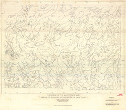
Elevation of the Water Table and Areas of Shallow Groundwater of Dane County
Open-file report; contains unpublished data that has not yet been peer-reviewed.-
Elevation of the Watertable and Areas of Shallow Groundwater of Dane County
1973
Map: 46.3 in x 40.5 in, scale 1:62,500
-
-
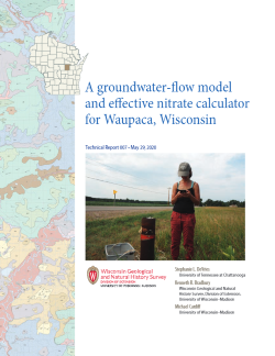
A Groundwater-Flow Model and Effective Nitrate Calculator for Waupaca, Wisconsin
The City of Waupaca, Wisconsin, uses groundwater pumped from a network of seven high-capacity wells as its municipal water supply. Recent increases in the concentration of nitrate in the municipal water supply raised questions about the source of this contamination and whether it might eventually exceed standards for drinking water. This study combines...-
Geodatabase of Study Data from Waupaca, Wisconsin [dataset 1]
2022
GIS Data: Geodatabase (.gdb file format)
-
Groundwater Flow Modeling Files from Waupaca, Wisconsin [dataset 2]
2022
Data: Groundwater-flow model files
-
Nitrate Calculators for Municipal Wells in Waupaca, Wisconsin [dataset 3]
2022
Data: Spreadsheets (.xlsx file format)
-
Characterization of Groundwater Resources in the Chequamegon-Nicolet National Forest, Wisconsin
Results of a comprehensive review and analysis of groundwater resources in the Chequamegon-Nicolet National Forest. The study was divided by location into four reports corresponding to the four main land units: Medford, Nicolet, Park Falls, and Washburn/Great Divide. Each report describes the results of the inventory, modeling, and analysis.-
Characterization of Groundwater Resources in the Chequamegon-Nicolet National Forest, Wisconsin: Medford Unit [GIS data]
2018
GIS Data: Geodatabase, metadata
-
Characterization of Groundwater Resources in the Chequamegon-Nicolet National Forest, Wisconsin: Medford Unit [plates]
2018
Map: 10 maps, 11 in x 17 in
-
Characterization of Groundwater Resources in the Chequamegon-Nicolet National Forest, Wisconsin: Nicolet Unit [GIS data]
2018
GIS Data: Geodatabase, metadata
-
Characterization of Groundwater Resources in the Chequamegon-Nicolet National Forest, Wisconsin: Nicolet Unit [plates]
2018
Map: 20 maps (10 each, northern and southern Nicolet Unit), 11 in x 17 in
-
Characterization of Groundwater Resources in the Chequamegon-Nicolet National Forest, Wisconsin: Park Falls Unit [GIS data]
2018
GIS Data: Geodatabase, metadata
-
Characterization of Groundwater Resources in the Chequamegon-Nicolet National Forest, Wisconsin: Park Falls Unit [plates]
2018
Map: 10 maps, 11 in x 17 in
- 2 more...
-
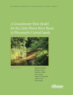
A Groundwater Flow Model for the Little Plover River Basin in Wisconsin's Central Sands
The bulletin describes the state-of-the-art scientific tool that can be used to help make good decisions about high-capacity well placement and pumping, as well as land use in Wisconsin's Central Sands region. It can also be used to predict which wells and well locations would have the greatest impact on nearby lakes and streams. The user's manual...-
A Groundwater Flow Model for the Little Plover River Basin in Wisconsin’s Central Sands [appendices]
2017
Data: PDFs + Excel files
-
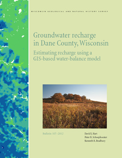
Groundwater Recharge in Dane County, Wisconsin: Estimating Recharge Using a GIS-Based Water-Balance Model
Hydrogeologists at the Survey developed a groundwater management tool to help guide land-use decisions in Dane County. The publication describes the inputs used to calculate recharge and includes a reduced-scale version of the recharge map. A full-scale version of the recharge data has been subsequently added as Dataset 1.-
GIS Data for Groundwater Recharge in Dane County, Wisconsin [dataset 1]
2012
GIS Data: File geodatabase, metadata
-
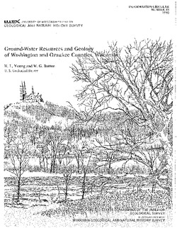
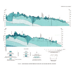
Ground-Water Resources and Geology of Washington and Ozaukee Counties, Wisconsin
-
Ground-Water Resources and Geology of Washington and Ozaukee Counties, Wisconsin
1980
Report: 37 p. + map and cross sections (scale 1:125,000)
-
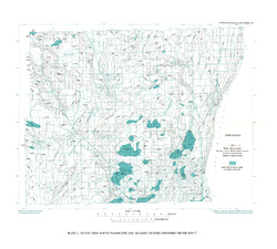
Water-Table Map of Washington and Ozaukee Counties, Wisconsin, Winter 1976-77
1980
Map: Scale 1:125,000
-
-
Ground-Water Conditions and the Effects of Lake Management on Ground Water in the Snake Lake Area, Woodruff, Wisconsin
Open-file report; contains unpublished data that has not yet been peer-reviewed. -
Assessing private well contamination in Grant, Iowa, and Lafayette counties: The southwest Wisconsin groundwater and geology study
The southwest Wisconsin groundwater and geology study (SWIGG) was a cooperative effort between Grant, Iowa, and Lafayette county governments, with scientists from the U.S. Geological Survey, U.S. Department of Agriculture, Marshfield Clinic Research Institute, and WGNHS. Researchers tested water quality in hundreds of private water wells across the three...-
Assessing private well contamination in Grant, Iowa, and Lafayette counties: The southwest Wisconsin groundwater and geology study
2023
Report: 47 p. (report) + 24 p. (appendices)
-

Publications Catalog
Wisconsin Geological and Natural History Survey