-
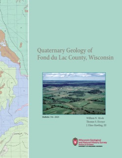
Quaternary Geology of Fond du Lac County, Wisconsin
The Quaternary geology of Fond du Lac County consists of glacial deposits and landforms dating to the last part of the Wisconsin Glaciation (ca. 20,000 to 12,000 yr BP) and nonglacial deposits and landforms of Holocene age (11,700 yr BP to present). Glacial till and meltwater sediment were deposited by the Green Bay and Lake Michigan Lobes of the...-
GIS Data for the Quaternary Geology of Fond du Lac County, Wisconsin [dataset 2]
2021
GIS Data: GeMS Level 3 file geodatabase (.gdb file format), shapefiles (.shp file format)
-
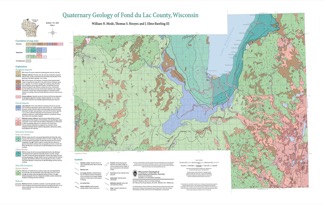
Quaternary Geology of Fond du Lac County, Wisconsin [plate 1]
2021
Map: 32 in x 20.25 in, scale 1:100,000
-
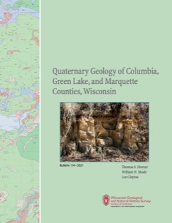
Quaternary Geology of Columbia, Green Lake, and Marquette Counties, Wisconsin
Columbia, Green Lake, and Marquette Counties were glaciated during the last ice age, and large areas were inundated with water from proglacial lakes and large meltwater rivers that occupied the valleys of the existing Wisconsin and Fox Rivers. These processes resulted in rolling upland hills, including drumlins punctuated by low-lying areas dominated by...-
GIS Data for the Quaternary Geology of Columbia, Green Lake, and Marquette Counties, Wisconsin [dataset 1]
2021
GIS Data: GeMS Level 3 file geodatabase (.gdb file format), shapefiles (.shp file format), GeoPackage (.gpkg file format)
-
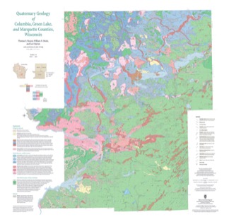
Quaternary Geology of Columbia, Green Lake, and Marquette Counties, Wisconsin [plate 1]
2021
Map: 35 in x 34 in, scale 1:100,000
-
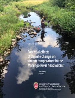
Potential Effects of Climate Change on Stream Temperature in the Marengo River Headwaters
Cold-water trout habitat in Wisconsin is projected to substantially decrease as a result of climate change. The extent of habitat loss depends, in part, on groundwater discharge to streams, which can provide cool-water refuges for trout. Survey hydrogeologists used field measurements and models of groundwater flow and stream temperature to evaluate how...-
GFLOW Groundwater Flow Model of the Marengo River Headwaters [dataset 1]
2021
Data: Groundwater flow model (.gfl file format), shapefiles (.shp file format)
-
Geodatabase - Three Baseflow Scenarios for the Marengo River Headwaters [dataset 2]
2021
GIS Data: File geodatabase (.gdb file format)
-
Measurements of Water Chemistry, Streamflow, and Stream Temperature from the Marengo River Headwaters [dataset 3]
2021
Data: Spreadsheets (.xlsx file format)
-
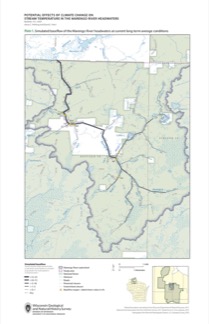
Simulated Baseflow of the Marengo River Headwaters with 21% Increase in Recharge [plate 2]
2021
Map: 11 in x 17 in
-
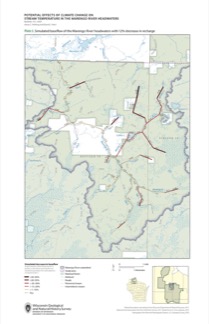
Simulated Baseflow of the Marengo River Headwaters with 12% Decrease in Recharge [plate 3]
2021
Map: 11 in x 17 in
-
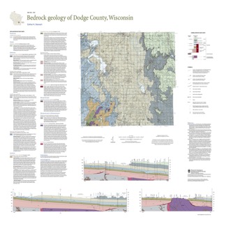
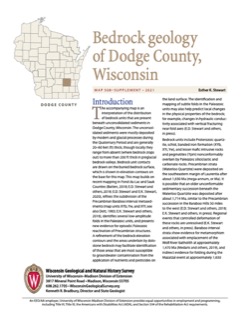
Bedrock Geology of Dodge County, Wisconsin
Dodge County lies in southeast Wisconsin, an area almost entirely covered by glacial deposits. This map interprets the distribution of the buried bedrock units across the county. Geologist Esther Stewart’s refinement of the bedrock elevation contours may help land-use planners identify areas most susceptible to groundwater contamination from applications...-
Supporting Data for the Bedrock Geology of Dodge County, Wisconsin
2021
Data: Spreadsheets (.xlsx file format)
-
GIS Data for the Bedrock Geology of Dodge County, Wisconsin [dataset 2]
2021
GIS Data: GeMS Level 3 file geodatabase (.gdb file format), shapefiles (.shp file format), GeoPackage (.gpkg file format)

Publications Catalog
Wisconsin Geological and Natural History Survey