-
Applications of the Columbia County, Wisconsin, Groundwater-Flow Model
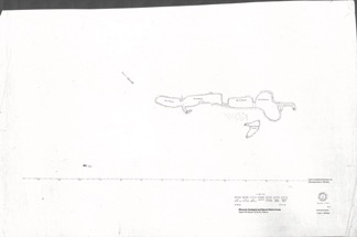
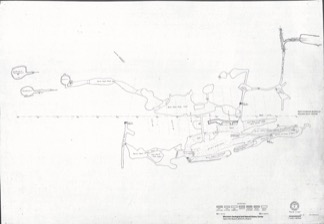
Computerized groundwater-flow models provide scientific analysis of water resources. Since its initial development in 2014, the Columbia County groundwater-flow model has been used to respond to requests for information about specific groundwater and land use issues. This companion report to the Hydrogeology and simulation of groundwater flow in Columbia... -
Hydrogeology and Simulation of Groundwater Flow in Columbia County, Wisconsin
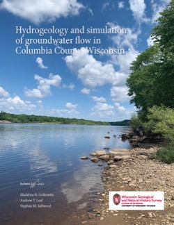
The WGNHS and the U.S. Geological Survey characterized the hydrogeology and developed a groundwater flow model to assess groundwater resources in Columbia County. This report describes regionally extensive aquifers and presents several extensive datasets collected from deep wells across the county. The report also documents the construction and... -
Quaternary Geology of Fond du Lac County, Wisconsin
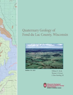
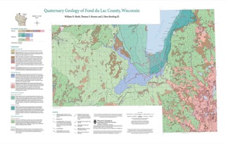
The Quaternary geology of Fond du Lac County consists of glacial deposits and landforms dating to the last part of the Wisconsin Glaciation (ca. 20,000 to 12,000 yr BP) and nonglacial deposits and landforms of Holocene age (11,700 yr BP to present). Glacial till and meltwater sediment were deposited by the Green Bay and Lake Michigan Lobes of the...-
GIS Data for the Quaternary Geology of Fond du Lac County, Wisconsin [dataset 2]
2021
GIS Data: GeMS Level 3 file geodatabase (.gdb file format), shapefiles (.shp file format)
-
Quaternary Geology of Fond du Lac County, Wisconsin [plate 1]
2021
Map: 32 in x 20.25 in, scale 1:100,000
-
Mineral Assessments for Conservation Easements in Wisconsin
If you’re thinking about donating land as a conservation easement but don’t own the subsurface (known as “severed mineral rights”), then you’ll need an assessment of the land’s mineral potential to determine whether the easement will qualify as a charitable tax deduction. Geologists at the Wisconsin Geological and Natural History Survey perform this... -
Depth-to-Bedrock Mapping in Wisconsin
Depth-to-bedrock maps show the thickness of unconsolidated materials overlying bedrock. These maps provide a key link between the underlying geology, groundwater flow, and land use and are important in guiding activities such as permitting, bridge construction, and the land application of waste products in sensitive areas. Given their role in guiding... -
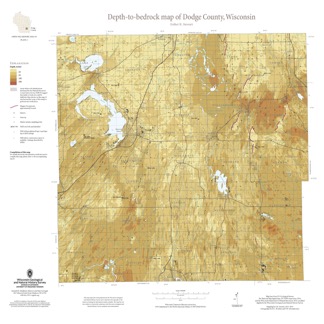
Depth-to-Bedrock Map of Dodge County, Wisconsin
This map shows thicknesses of deposits of unconsolidated materials above the bedrock. Across the county, depth to bedrock ranges from 0 feet, where bedrock is exposed, to over 250 feet within bedrock valleys. Areas with bedrock depths shallower than 20 feet are of particular importance for land-use planning and to the construction stone industry. Such... -
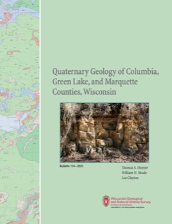
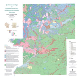
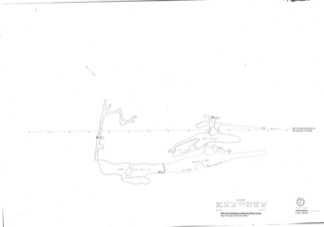
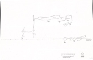
Quaternary Geology of Columbia, Green Lake, and Marquette Counties, Wisconsin
Columbia, Green Lake, and Marquette Counties were glaciated during the last ice age, and large areas were inundated with water from proglacial lakes and large meltwater rivers that occupied the valleys of the existing Wisconsin and Fox Rivers. These processes resulted in rolling upland hills, including drumlins punctuated by low-lying areas dominated by...-
GIS Data for the Quaternary Geology of Columbia, Green Lake, and Marquette Counties, Wisconsin [dataset 1]
2021
GIS Data: GeMS Level 3 file geodatabase (.gdb file format), shapefiles (.shp file format), GeoPackage (.gpkg file format)
-
Quaternary Geology of Columbia, Green Lake, and Marquette Counties, Wisconsin [plate 1]
2021
Map: 35 in x 34 in, scale 1:100,000
-
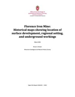
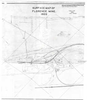
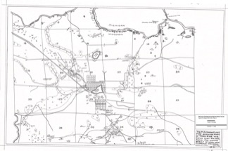
Florence Iron Mine: Historical Maps Showing Location of Surface Development, Regional Setting, and Underground Workings
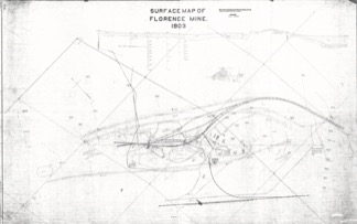
From 1880 to 1931, an extensive iron mine operated near the city of Florence in northeast Wisconsin. These 21 maps from its middle years of operation are the only surviving records of what exists below the surface. These maps are of historical interest for their record of surface features that are no longer in existence. They may also have potential...-
Extent of Florence Mine Surface Development in 1903 [plate 1]
2021
Map: 56 in x 35.1 in, scale 1 in = 100 ft
-
Florence Mine Surface Development in 1903 With Annotated Shaft Locations [plate 2]
2021
Map: 33.3 in x 38.2 in, scale 1 in = 100 ft
-
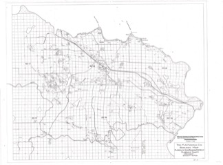
Mines in the Area Adjacent to the City of Florence in 1928 [plate 3]
2021
Map: 29.7 in x 19.7 in, scale 1 in = 1/4 mile
-
Florence Iron Mining District Covering Part of Florence County [plate 4]
2021
Map: 36.3 in x 26.8 in, scale 1 in = 1/2 mile
-
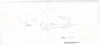
Florence Mine Level 1 With Annotated Shaft Locations and Surface Features [plate 5]
2021
Map: 52.8 in x 24.3 in, scale 1 in = 100 ft
-
Florence Mine Level 1 (1910), Northwest Ore Zone [plate 7]
2021
Map: 27 in x 19 in, scale 1 in = 60 ft
-
Florence Mine Level 2 (1907), Northwest Ore Zone [plate 9]
2021
Map: 27.1 in x 18.8 in, scale 1 in = 60 ft
- 12 more...
-
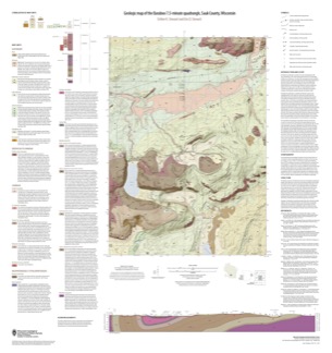
Geologic Map of the Baraboo 7.5-Minute Quadrangle, Sauk County, Wisconsin
The Baraboo quadrangle, records where glaciers stopped in the east-central Baraboo Hills. On this map, 1:24,000 scale, Precambrian igneous and metasedimentary rocks are overlain by Paleozoic sedimentary rocks and, more recently, by glacial deposits. Superb exposures of all three can be found in Devils Lake State Park and Parfreys Glen State Natural Area.-
Geologic Map of the Baraboo 7.5-Minute Quadrangle, Sauk County, Wisconsin
2021
Map: 35 in x 37 in, scale 1:24,000
-
-
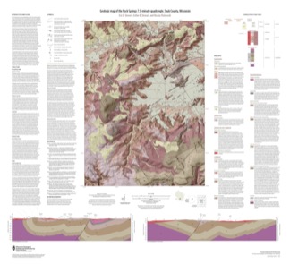
Geologic Map of the Rock Springs 7.5-Minute Quadrangle, Sauk County, Wisconsin
The Rock Springs quadrangle is located in the western Baraboo Hills of south-central Wisconsin. This map, 1:24,000 scale, conveys the rich Precambrian through Quaternary history present on the ground. Here, ancient rocks metamorphosed and folded and were later displaced by a series of faults. Although never glaciated, an ice sheet 8 kilometers to the east...-
Geologic Map of the Rock Springs 7.5-Minute Quadrangle, Sauk County, Wisconsin
2021
Map: 40 in x 36.5 in, scale 1:24,000
-
-
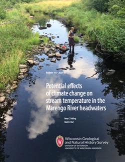
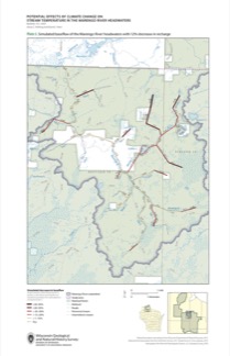
Potential Effects of Climate Change on Stream Temperature in the Marengo River Headwaters
Cold-water trout habitat in Wisconsin is projected to substantially decrease as a result of climate change. The extent of habitat loss depends, in part, on groundwater discharge to streams, which can provide cool-water refuges for trout. Survey hydrogeologists used field measurements and models of groundwater flow and stream temperature to evaluate how...-
GFLOW Groundwater Flow Model of the Marengo River Headwaters [dataset 1]
2021
Data: Groundwater flow model (.gfl file format), shapefiles (.shp file format)
-
Geodatabase - Three Baseflow Scenarios for the Marengo River Headwaters [dataset 2]
2021
GIS Data: File geodatabase (.gdb file format)
-
Measurements of Water Chemistry, Streamflow, and Stream Temperature from the Marengo River Headwaters [dataset 3]
2021
Data: Spreadsheets (.xlsx file format)
-
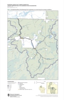
Simulated Baseflow of the Marengo River Headwaters with 21% Increase in Recharge [plate 2]
2021
Map: 11 in x 17 in
-
Simulated Baseflow of the Marengo River Headwaters with 12% Decrease in Recharge [plate 3]
2021
Map: 11 in x 17 in
-
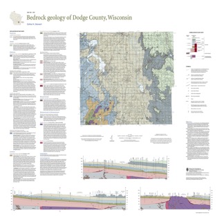
Bedrock Geology of Dodge County, Wisconsin
Dodge County lies in southeast Wisconsin, an area almost entirely covered by glacial deposits. This map interprets the distribution of the buried bedrock units across the county. Geologist Esther Stewart’s refinement of the bedrock elevation contours may help land-use planners identify areas most susceptible to groundwater contamination from applications...-
Supporting Data for the Bedrock Geology of Dodge County, Wisconsin
2021
Data: Spreadsheets (.xlsx file format)
-
GIS Data for the Bedrock Geology of Dodge County, Wisconsin [dataset 2]
2021
GIS Data: GeMS Level 3 file geodatabase (.gdb file format), shapefiles (.shp file format), GeoPackage (.gpkg file format)

Publications Catalog
Wisconsin Geological and Natural History Survey