
Geology of the Baraboo District, Wisconsin: A Description and Field Guide Incorporating Structural Analysis of the Precambrian Rocks and Sedimentologic Studies of the Paleozoic Strata
Data and Resources
-
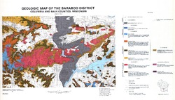
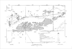
Geologic Map of the Baraboo District, Columbia and Sauk Counties, Wisconsin [plate 1]
1970
Map: 39.5 in x 22.7 in, scale 1:62,500
-
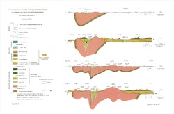
Geologic Cross Sections of the Baraboo District, Columbia and Sauk Counties, Wisconsin [plate 2]
1970
Plate: 32 in x 21 in
-
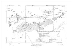
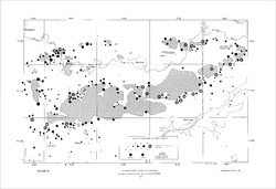
Map of Main Phase Minor Structures in the Baraboo Syncline, Columbia and Sauk Counties, Wisconsin [plate 3]
1970
Map: 31.5 in x 21.5 in
-
Structural Map of the Baraboo Syncline, Columbia and Sauk Counties, Wisconsin [plate 4]
1970
Map: 31.5 in x 21.5 in
-
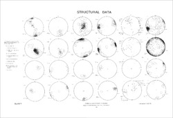
Structural Data: Lower Hemisphere Equal-Area Stereoplots of Structural Elements in the Baraboo Quartzite [plate 5]
1970
Plate: 31.5 in x 21.5 in
-
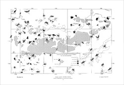
Orientations of Cross Stratification in Cambrian and Ordovician Sandstones [plate 7]
1970
Map: 31.5 in x 21.5 in
Related Collections
-

Information Circular
View Information Circular